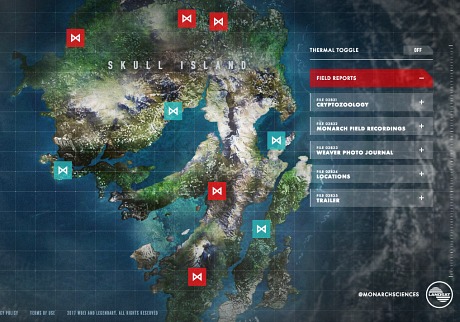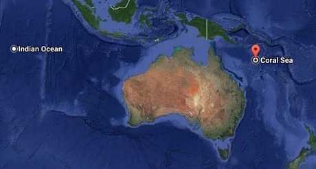
What a difference between this sophisticated digital map of the all-new, better-than-before Skull Island vs. the crude, hand-drawn map that Robert Armstrong had in his breast pocket in the original King Kong (’33). The shape of it, obviously, resembles a gorilla skull profile. I’m not finding a legend but I’m guessing it’s roughly 25 miles long and maybe 13 or 14 miles wide. The location is a bit of a mystery. One link says it’s located 1800 miles southwest of Central America and due west of Ecuador/Peru while an Alternate Reality Game (ARG) places it in the Coral Sea off the east coast of Australia, south of the Solomon Islands and north of New Caledonia. (I’m inclined to go with the latter given the proximity to Vietnam.) The 1933 island was located west of Sumatra, somewhere in the southeast region of the Indian ocean.